Sara and I recently returned from a trip to the Maritimes where we drove out, attended a convention, then did more sightseeing - mostly by car - before driving back. Here is the story of that trip.
We had made our first visit to the Maritimes last year for the inaugural Supernova board game convention. A friend of ours, Kris, had moved home to Halifax years ago to open his own board game cafe, The Board Room. Between the business and a new baby, he wasn't able to travel as much to conventions, so he decided to start his own, on an invite-only basis. Sara - who loves driving, but sold her last car years ago - tried to talk me into driving out and back, but I was dubious about the process, and didn't have enough vacation days to spare. We flew instead, taking only one extra day after the con to drive a rented car to Peggy's Cove and the excellent Oaklawn Farm Zoo. This year, with the con happening again, Sara convinced me to drive out and back, and with my able interference, began planning the trip. In the end we only booked hotels for five of the twelve nights, leaving our plans open for the rest of the time. We would often end up using Booking.com, sometimes in combination with Google Maps, during late afternoon or at dinner to find a hotel once we knew about where we would be once we were tired.
We had made our first visit to the Maritimes last year for the inaugural Supernova board game convention. A friend of ours, Kris, had moved home to Halifax years ago to open his own board game cafe, The Board Room. Between the business and a new baby, he wasn't able to travel as much to conventions, so he decided to start his own, on an invite-only basis. Sara - who loves driving, but sold her last car years ago - tried to talk me into driving out and back, but I was dubious about the process, and didn't have enough vacation days to spare. We flew instead, taking only one extra day after the con to drive a rented car to Peggy's Cove and the excellent Oaklawn Farm Zoo. This year, with the con happening again, Sara convinced me to drive out and back, and with my able interference, began planning the trip. In the end we only booked hotels for five of the twelve nights, leaving our plans open for the rest of the time. We would often end up using Booking.com, sometimes in combination with Google Maps, during late afternoon or at dinner to find a hotel once we knew about where we would be once we were tired.
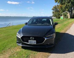 Our Mazda 3
Monday, September 16th: Sara and I headed over to Enterprise Car Rental, where we had a two-week rental already scheduled, to see if they had anything in stock that matched our preferences. Sara had certain car types she did not want, and was very much hoping for a sunroof. They did not have anything suitable, but expected to have three returned the next day that were, so we deferred picking the car up until then. At home, we did the last of our laundry, and packed and repacked until everything had been accounted for. Sara had come up with a system where most of our clothes were packed into small bags, one bag per day, with the things we need every day (toiletries, chargers, books, etc.) in my backpack. This meant that we could bring a minimum of stuff into each hotel, instead of lugging a mostly-useless suitcase in each time. Everything was consolidated and laid out with a checklist for the next day.
Tuesday, September 17th: After working a half-day, I headed back to Enterprise and selected an almost-new Mazda 3 from the options available. After loading it up at our apartment, I drove to Sara's work at the CNE. She swapped in as driver (as she would be for the lion's share of the trip) and took us out. Our first stop was not far from the city: a late lunch at Los Cabos in Whitby, an excellent Mexican restaurant that we can't get to very often. From there we kept heading east, and after swinging south of Montreal as the sun set, used the internet to scout hotels ahead of us. We finally took a room at a motel in Drummondville, about a third of the way from Montreal to Québec, and turned in.
Side note: I found in my readings that "Québec" on street signs, by itself, would refer to the city, and did some reading to find out why. It turns out that the French language treats cities and provinces differently, so (for example) if I said that I was in the province of Quebec, that would be "au Québec", while in the city would be "à Québec". English does not differentiate in this way, though, so "Quebec City" is used for ease of comprehension.
Side note: I found in my readings that "Québec" on street signs, by itself, would refer to the city, and did some reading to find out why. It turns out that the French language treats cities and provinces differently, so (for example) if I said that I was in the province of Quebec, that would be "au Québec", while in the city would be "à Québec". English does not differentiate in this way, though, so "Quebec City" is used for ease of comprehension.
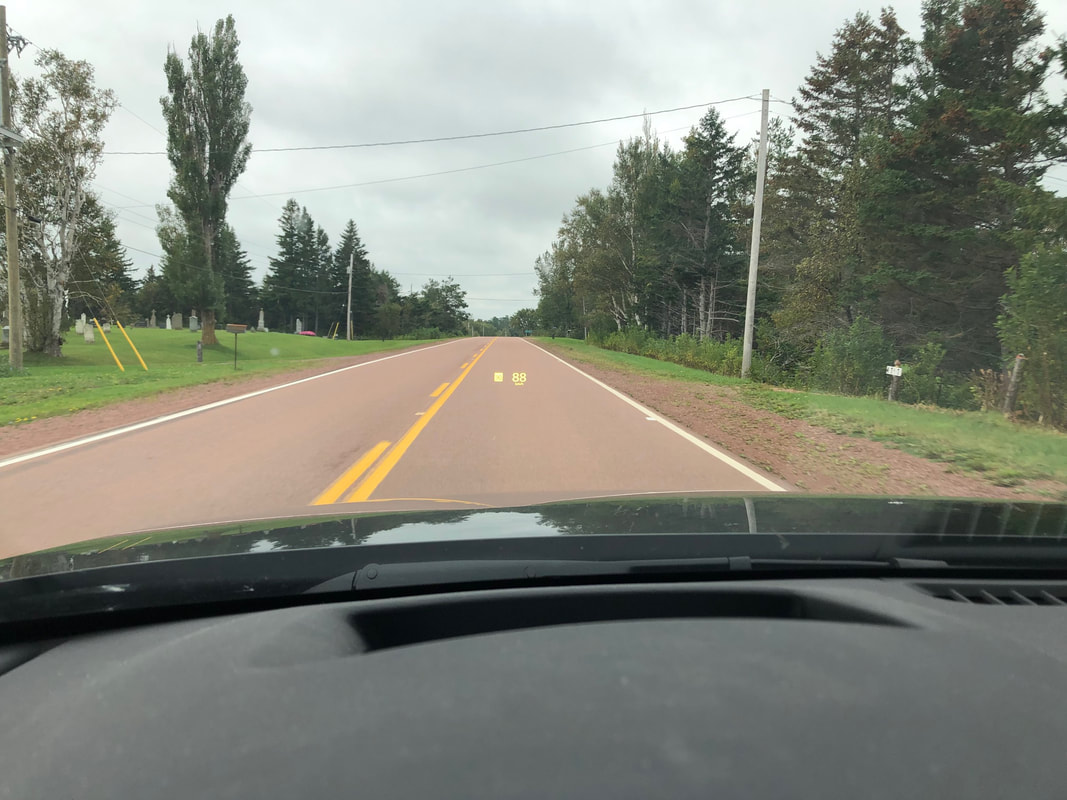
Wednesday, September 18th: We were both up around 5 am. This is not unusual for Sara, who will typically rise between 5 and 6 am regardless of bedtime. It is less usual for me. I both wake up and fall asleep fairly easily, so while I will often stir when Sara gets up, it's rare for me to agree to being up for the day first thing. We were both eager to be on the road early that day though, and knew that I'd likely nap along the way anyway. Morning ablutions and breakfast at McDonald's saw us on the road not long after 6. We continued to take a fairly direct route to Halifax, driving east through Quebec (fun place name: Saint-Louis-du-Ha! Ha!) before turning south into New Brunswick. We did have some sightseeing planned, and stopped for lunch at the Potato World Museum, looking through their exhibits on the advantages of the potato. Turns out it has a lot more vitamin C than I thought! Our route then took us over the Hartland Covered Bridge, the longest covered bridge in the world. I took over driving duties, running the bridge over and back again so Sara could take pictures, and drove us to the world's largest axe in Nackawic. Sara swapped back in, and we continued to Nova Scotia, detouring east for a route that looked like it went along the coast, but it turns out that roads that look coastal don't always have a reasonable view, so we had to detour from our detour to get a quick glimpse of the ocean as the sun was going down. We finally turned south and spent the night in Truro, about an hour from Halifax.

The beautiful St. John River
|
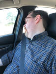
A little in-car nap
|
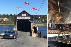
Hartland Covered Bridge
|
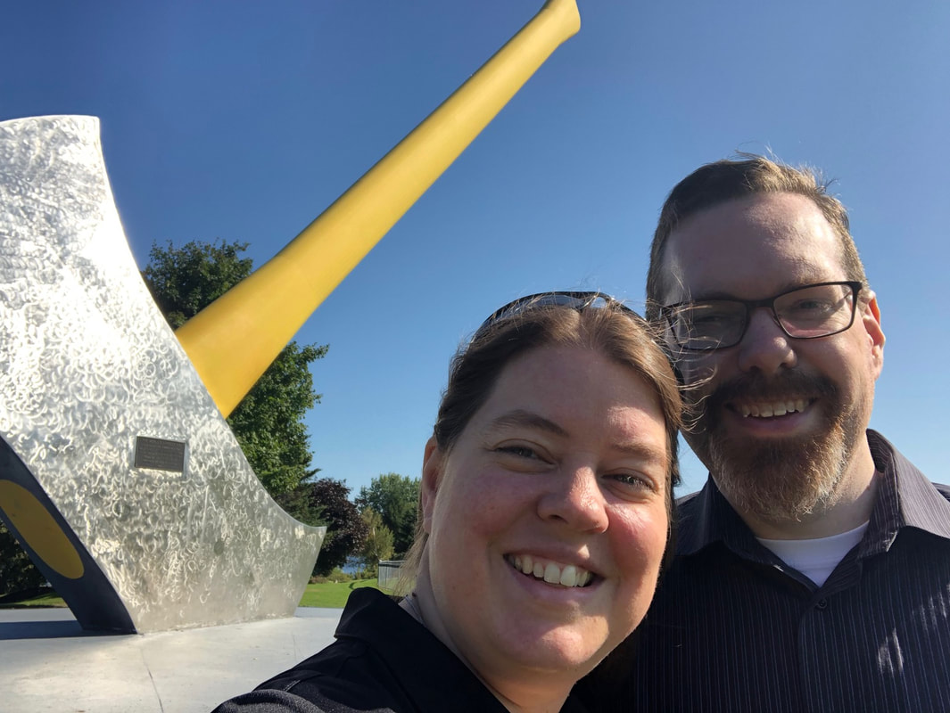
World's Largest Axe
|
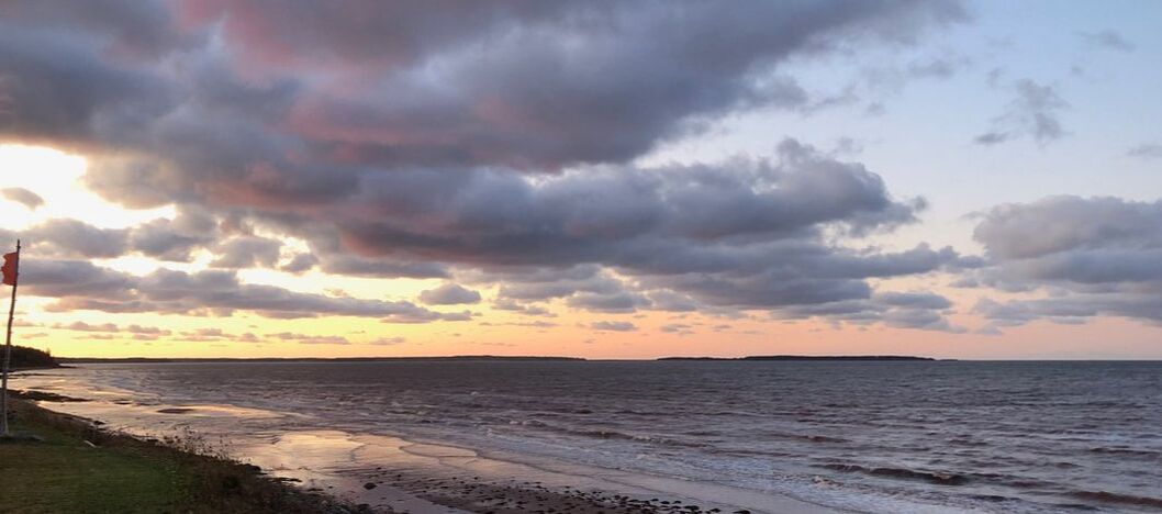
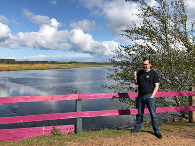
Our first view of the ocean (or the Northumberland Strait for those pedantic types) with PEI in the distance (we think!)
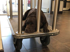 The hotel's Welcome Ambassador
Thursday, September 19th: Our drive in Halifax took us through some gorgeous rolling country. Most of our sightseeing on the trip was done from the car, with occasional stops, and we were happiest when we were able to view one or more of: hills and/or mountains; large bodies of water; trees in fall colours; and well-built architecture. The area between Truro and Halifax gave us hills and trees, giving way to water as we came in to the city. Supernova had changed locations from the previous year, being held at Chocolate Lake, just off the Northwest Arm of Halifax Harbour. This was about 15 minutes west of the city core, so native Haligonians had more problems getting there than before. This concludes the list of ways that the new location was not better than the old one. Instead of being tucked away in the basement, we were in a spacious second-floor room with plenty of natural light, a view of the lake, and a balcony. Sara and I met up with Trevor, a good friend of ours from Toronto that we don't get together with nearly enough, and started the con with Dominion, which is somewhere on the all-time top game lists of all of us. We didn't finish it before it was time for the boat tour Kris had arranged, though. We had been split into groups for the tour, and Sara, Trevor and I climbed into an inflatable tour boat with Kris, board game designer Daryl Andrews (of Sagrada fame, among others) and photographer extraordinaire Ian Summerbell. Our guide was excellent, talking to us about the mansions lining the Northwest Arm, the history and geography of the area, and the various attractions we could see from the water. He also swung us into Purcells Cove to show us some of the damage from Hurricane Dorian, which had smashed through less than two weeks before. He kept us out as long as he could, getting us back to shore just in time for us to make the pre-planned lunch at the Armview Restaurant, where we joined the other groups. After that it was back to the hotel, and we settled in for three more full days of board games.
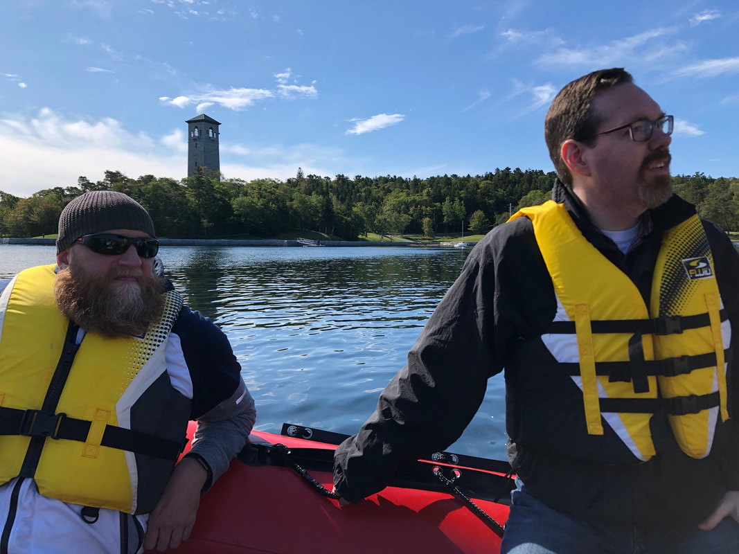
Trevor & Duncan on the boat tour
|

One of the amazing mansions
|
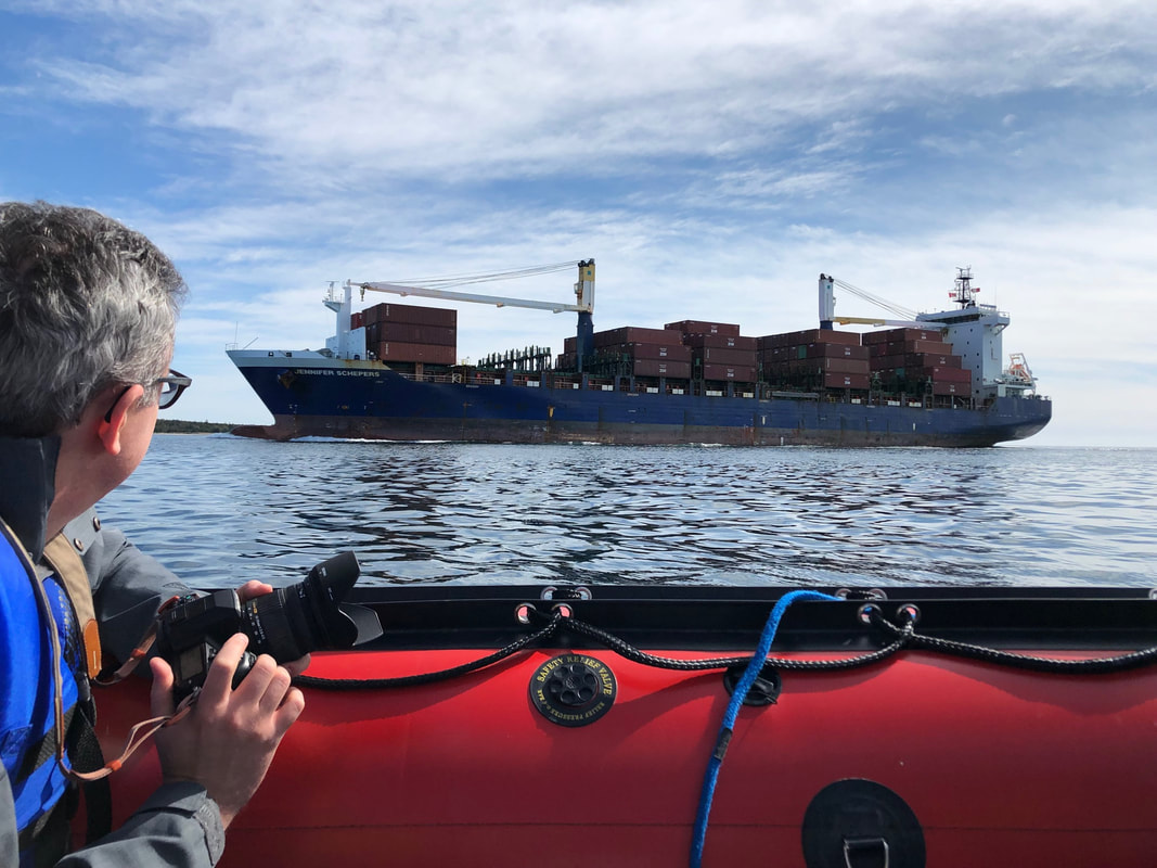
Ian watching the container ship
|
Supernova: The four days of the con were highly enjoyable. Sara, Trevor, and I gamed together for almost the entire weekend - I played only two games that didn't have Sara, and the only games other than those without Trevor were early Sunday morning when it was just the two of us. I played 26 games, 5 of which were new to me, and met many enjoyable people. My birthday fell during the con, but I didn't feel any need to celebrate it - a day at Supernova was wonderful enough!
Saturday was the Math Trade. Halifax apparently values games differently than Toronto, so Sara and I had traded several games that we hadn't had luck getting rid of locally. The trade was run at the Board Room downtown, and set up very efficiently, so we were in and out in about half an hour. Saturday also featured the first Canadian running of the Spiel-A-Thon. This charity event lets partipants pay $5 to run a gauntlet of 8 boardgame-related challenges, with the fastest times qualifying for playoff rounds for prizes. The proceeds are used to supply games to local children's hospitals and senior citizen's centres, and the event raised over $1400.
On Sunday morning, Sara finally did what she'd wanted to the whole time, playing games outside. The two of us started the day with Ra: The Dice Game out on the balcony, before coming inside due to the wind. She later got 7 of us to play On Tour outside, using some plexiglass sheets to protect the public display of cards. It was very enjoyable, although I did get a mild sunburn on the back of my neck from it. Apparently I had not sufficiently prepared for time outside. This would unfortunately not be the last time Mother Nature would get me during the trip.

Ra: The Dice Game
|

On Tour (Photo by Trevor)
|
Sunday, September 22nd: At the close of the con, Sara and I took Daryl to the airport on our way out of the city. It was mostly on our way, as we were aimed for a resort in Liscomb, on what is called the Eastern Shore of Nova Scotia. We arrived after dark and checked in, being told that we were staying at a cabin just down the road, which was in the middle of some construction. The road was down to one lane just after the main part of the resort, and we sat at the red light for several minutes before running it to drive the ~100 feet to our destination. Our cabin (they called it a chalet) was wonderful. Mostly one room with a separated bathroom, it had windows on all four sides, a comfortable bed, and tons of character. We could hear the river running about 30 feet from our front door, but unfortunately could not see it in the dark. We walked back to the main resort using the tunnel under the road and browsed their facilities, declining a swim. They had a dedicated board game loft, but unfortunately were sadly lacking in modern games, catering more to the pre-teen crowd. We did find their recreation building, and played a couple rounds of pool before heading back to the chalet, lighting a fire for some warmth, and curling up to watch a bit of the Emmys.
Monday, September 23rd: A peculiar squealing noise unfortunately woke me before I really wanted to be up. One of the construction vehicles was being cleared out of the way to make room for the day's work, and needed a tune-up of some kind. We watched as two cranes lifted part of a new bridge over the river into place, then headed to breakfast. This proved to be the best hotel breakfast we would have on the trip, with sausages and peameal bacon, fresh fruit, and what seemed like non-mass-produced cream and strawberry topping for the waffles. Our table also overlooked the river, with birdfeeders just outside the windows attracting blue jays for us to admire while we ate. If anyone is looking for a place to stay east of Halifax, I would happily recommend the Liscombe Lodge!
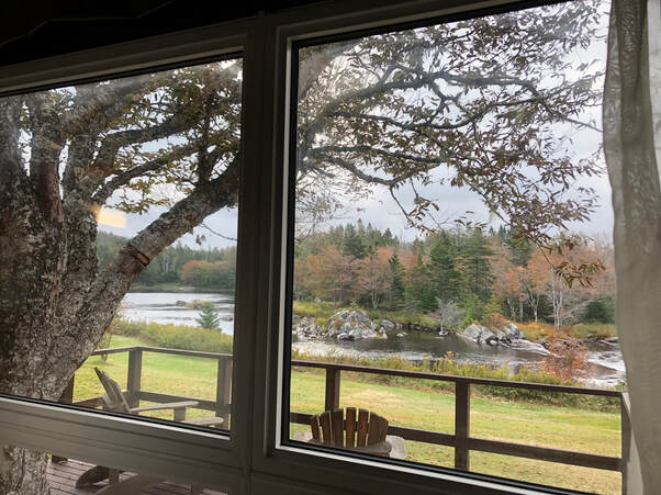
View of the Liscomb River from our chalet
|
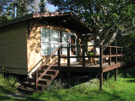
Our chalet
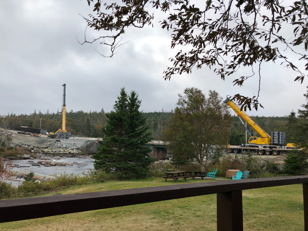
Bridge construction in the other direction
|
Our plan for Monday involved driving into and then circumnavigating Cape Breton Island. The first part of the drive was pleasant but unexceptional, but things really picked up once we got inland on Cape Breton. Our path followed the south shore of the Bras d'Or Lake, offering us many wonderful views of the lake and the hills beyond. We found a quaint food truck overlooking the tip of the lake where we stopped for our only seafood of the trip.
|
Side note: neither Sara nor I are big fans of seafood, which was a bit of a problem. Everywhere we went, we saw signs for lobster and other seafood, and the dishes at many of the restaurants we considered turned out to be primarily ocean-based. Luckily, many restaurants have online menus these days, so we were able to find this out before actually driving there. Unluckily, between looking up restaurants, checking maps, and reading an online serial, I blew through my data cap for the month. Hopefully the overage fees aren't too bad!
|
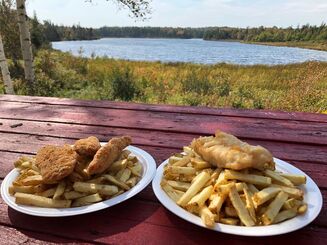
Fish & Chips @ Bras d'Or
|

Closest encounter with a lobster, from Charlottetown
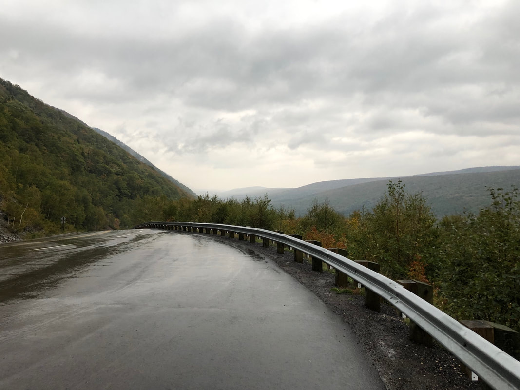
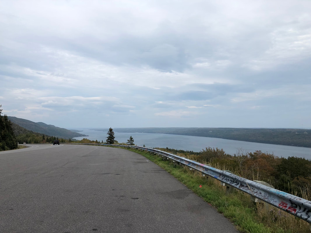
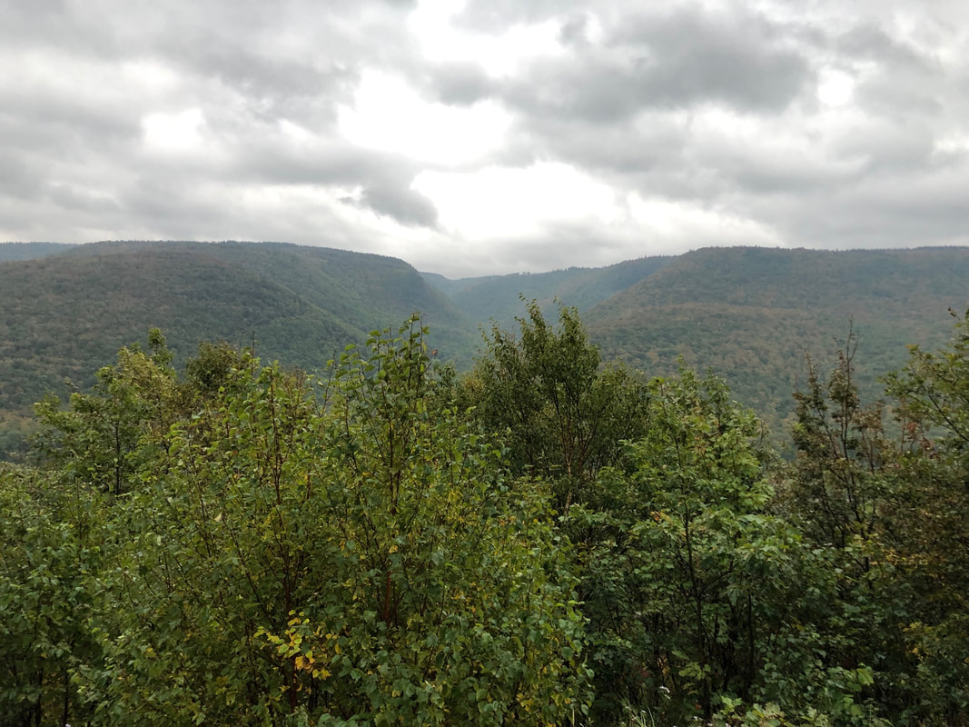
Once past, we turned south to meet up with the Mira River, which I was interested in due to high school choir. Allistair McGillivray's Song for the Mira, as well as other songs like Away from the Roll of the Sea and Cape Breton Lullaby, had stuck with me ever since. The Mira turned out to be pleasant but not impressive, and we headed north, following the coastal road where we could. We found impressive a little while later at Kelly's Mountain, where the highway used a switchback to ascend a great deal in a short distance, giving us a spectacular view from the lookout at the top. We continued north, eventually entering Cape Breton Highlands National Park. The coastal views, with the hills on our left, were wonderful, but the most impressive sights came after we headed inland to cut through the highlands themselves. The hills. Wow, the hills! Beautifully forested, majestic, rolling hills everywhere. Truly one of the high points of the trip.
Cape Breton Highlands National Park
|
Coastal views on Cape Breton
Kelly's Mountain
Cape Breton Highlands
|
It had been spitting somewhat while we made our way through the park, and this turned to full-on rain as we exited the park on the west side of the island. The sun also went down shortly thereafter, making the last part of the day's drive to our bed and breakfast less enjoyable.
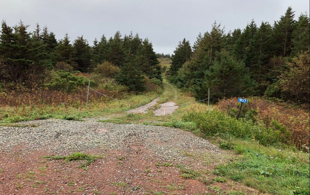
"That's definitely the road the GPS wants us to take"
|
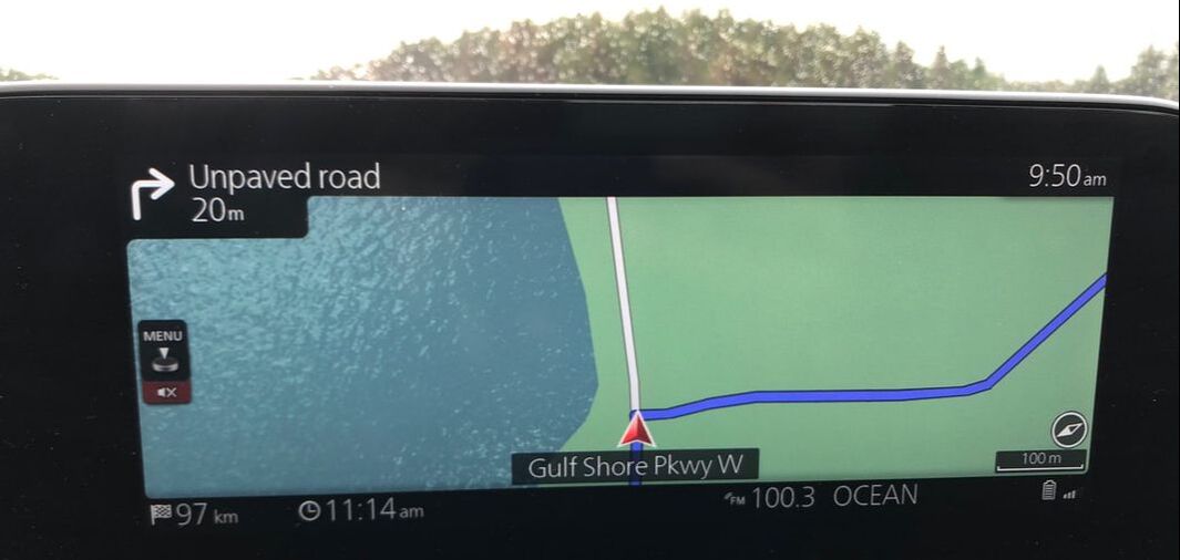
It was also around this time that we developed something of a distrust for our car's path-finding abilities. To digress for a bit: we largely enjoyed the car, but there were a few things that could have been better. For instance, the car had a powered driver's seat, and you could save up to two driver profiles, so Sara and I could switch between us easily. However, every time the car was unlocked, it automatically moved the seat all the way down and back, and we couldn't find a way to stop it from doing this. Because Sara was driving almost all of the time, this meant that we had to wait for it to reset itself every single time we came back. We also couldn't set a new destination while driving - we had to do so while stopped, even though I could do it while Sara was driving. And while coming down the west side of Cape Breton, it was showing us a different path than Google Maps on my phone was. We decided to try the Google Maps way, and turned right instead of going straight. After recalculating, the car immediately dropped 5 minutes from our ETA. So it could tell that this way was better, but hadn't figured it out - which really should be its job!
|
|
We eventually got to the B&B, a converted mansion in Port Hood. The proprietor had left for the night already, but, forewarned that we were arriving shortly, had left us keys at the door. We could once again hear but not see the nearby water, and just played a game of Sagrada before turning in.
Tuesday, September 24th: We finally got to meet the proprietor at breakfast, and also traded some stories with the other couples staying there. Our plans after this stay were very free-form; we wanted to get into Prince Edward Island, but hadn't been specific as to when, or where we'd stay on any later days. We drove down the coast of Cape Breton Island, crossed back into mainland Nova Scotia, and headed towards the PEI ferry, switching to a more coastal road when we could for the scenery. We got hungry while not far from New Glasgow, and Google helped us find a great Italian place, Cafe Italia. |
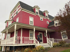
Hillcrest Hall Country Inn
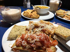
Pasta @ Cafe Italia
|
We took a stroll down New Glasgow's waterfront before departing, during which I collected some mosquito bites. We finally got to the ferry crossing about an hour before the next scheduled departure, partially because we didn't want to make a reservation. Neither the ferry nor the bridge to PEI charge on the way in; both, instead, charge you for the way out. Leaving on the ferry would cost $79; leaving on the bridge was only $47.75. So taking the ferry in and the bridge out would save us $30, but we couldn't reserve a spot on a specific ferry crossing ahead of time without paying a round-trip cost. So, early to arrive it was! It turned out not to be an issue, as at this time of year they had plenty of non-commercial space. Sara drove us up a ramp onto the second floor of the ferry and we headed upstairs to the passenger and then observation decks. Once underway, we tried to orient ourselves against Google Maps, and a friendly gentleman named Stephen took pity on us and helped us understand what kind of scale we were looking at things at. (Answer: much bigger than we first thought!)
We drove off the ferry on the other side and turned right to start the official Points East Coastal Drive. We found nice scenery, gorgeous red sand beaches, a lighthouse with complimentary bunny, and way more cows and Canada Post vehicles than we expected. We were near the town of Montague as hunger set in, and after several false starts ate dinner at Windows on the Water, overlooking Montague's harbour. More confusion about why Google thought the local inn (which looked very reasonable) was one-star led to a rather awkward interaction with their front desk person. (Duncan: "What are your bathroom facilities like?") In the end we stayed, and were not displeased. Not wanting to drive further with the sun down, we spent a while wandering Montague, with stops for Tim Horton's, a liquor store, a house for sale, a very friendly cat, and the end of one of the Confederation Trail spurs. I also collected more mosquito bites - apparently I am both more delicious to them and more reactive to the bites than Sara is. Grumble.
We drove off the ferry on the other side and turned right to start the official Points East Coastal Drive. We found nice scenery, gorgeous red sand beaches, a lighthouse with complimentary bunny, and way more cows and Canada Post vehicles than we expected. We were near the town of Montague as hunger set in, and after several false starts ate dinner at Windows on the Water, overlooking Montague's harbour. More confusion about why Google thought the local inn (which looked very reasonable) was one-star led to a rather awkward interaction with their front desk person. (Duncan: "What are your bathroom facilities like?") In the end we stayed, and were not displeased. Not wanting to drive further with the sun down, we spent a while wandering Montague, with stops for Tim Horton's, a liquor store, a house for sale, a very friendly cat, and the end of one of the Confederation Trail spurs. I also collected more mosquito bites - apparently I am both more delicious to them and more reactive to the bites than Sara is. Grumble.

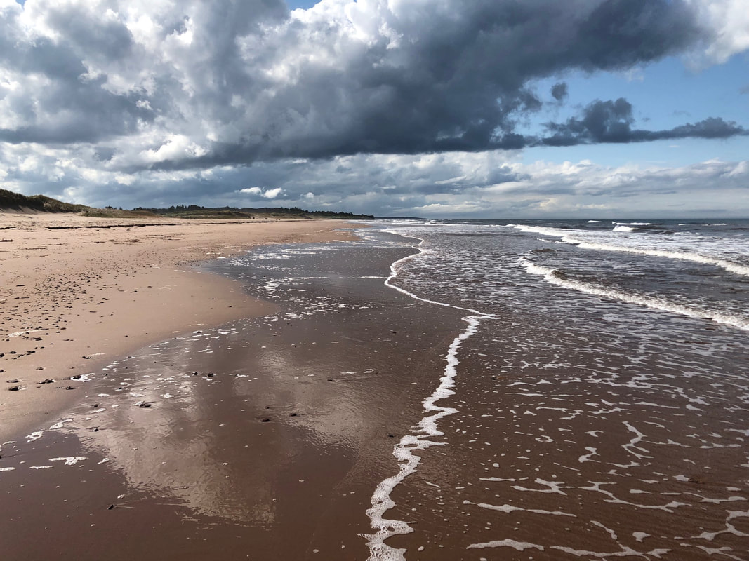
One of the beautiful red sand beaches of PEI
|
The beautiful red roads of the Maritimes
Many boats seem to double as planters
|
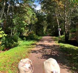
Wednesday, September 25th: We wanted a lighter day, and I aimed us for Charlottetown, realizing afterwards that taking the direct route in would make for a very short day. We turned north to drive around the Hillsborough River, following the west bank up and seeing the sights, including an unfortunately-closed Rob Roy's Country Kitchen. A stop in Mt Stewart provided lunch and ice cream, and we headed off on a trail that promised great scenery and a place to view birds at the end of it. The bridge that we found first was indeed very scenic, but unfortunately the mosquitos were out in force, and we turned back long before making it to the bird-watching area. I collected well over a dozen bites in the process, resulting in an itchy couple of days.
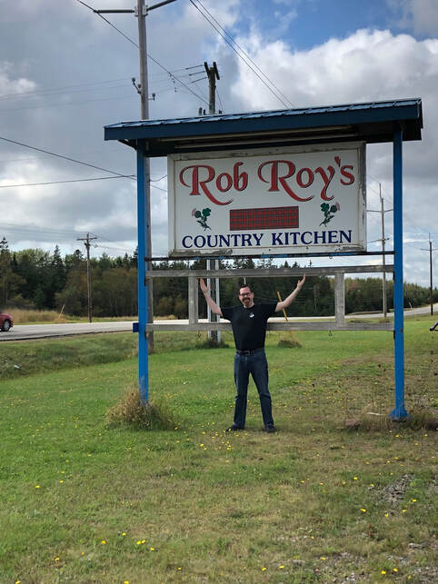
Rob Roy's Country Kitchen
|
ADL ice cream along the Confederation Trail
A beautiful view along the Confederation Trail
|
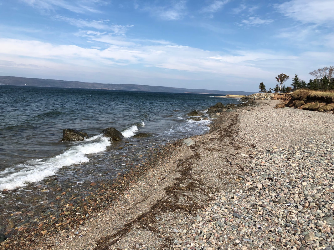
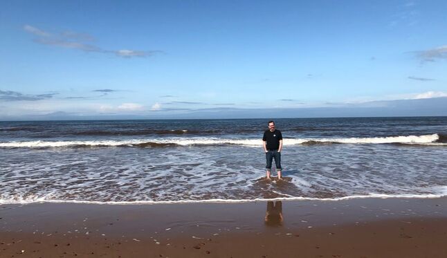
Driving north, we found a path down to a beach that was closed for the season but still easily accessible, and wandered through the surf for quite a while, enjoying the sight, sound, and feel of the waves.
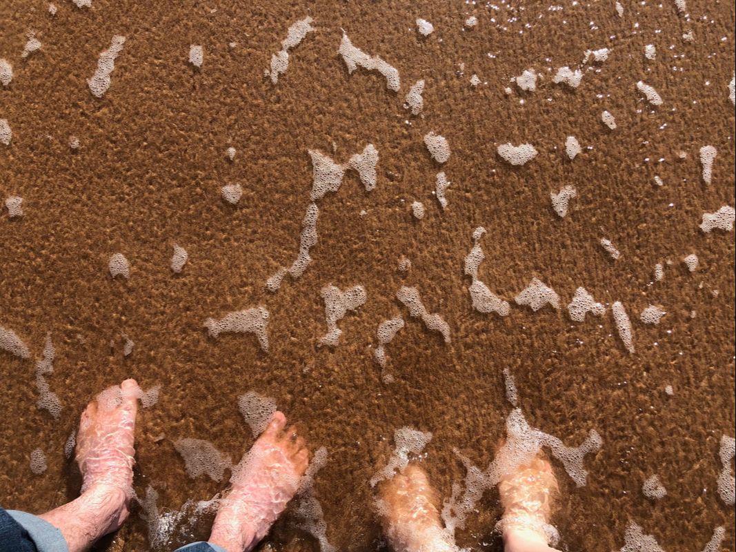
Playing in the Gulf of St Lawrence
|
|
We returned to Charlottetown down the east side of the river, checking in to the Dundee Arms Inn. This was a converted Victorian mansion, and our room weirdly had a full tub in the same room as the bed and TV, with the shower and toilet separated from that room by a door and a couple stairs. I guess that's what you get when you renovate a classical mansion!
We returned to Charlottetown down the east side of the river, checking in to the Dundee Arms Inn. This was a converted Victorian mansion, and our room weirdly had a full tub in the same room as the bed and TV, with the shower and toilet separated from that room by a door and a couple stairs. I guess that's what you get when you renovate a classical mansion!
Stairs of the Dundee Arms Inn
|
We continued the light day by heading over to PEI's only board game cafe, Small Print. We had some problems finding an entrance, missing the street-level door and then having problems getting in through the attached mall. We finally made it and found the only occupants to be the new co-owner and her husband! She was training him on the different food items and teaching some games, and we gave them some things to do while learning a few games from their collection. No real hits, but at least now we know that. It turned out that this was a weirdly quiet night for them, so it was good for them that we wandered by, if only okay for us.
|
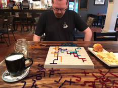
Nexos @ Small Print Cafe

Games Played @ Small Print
|
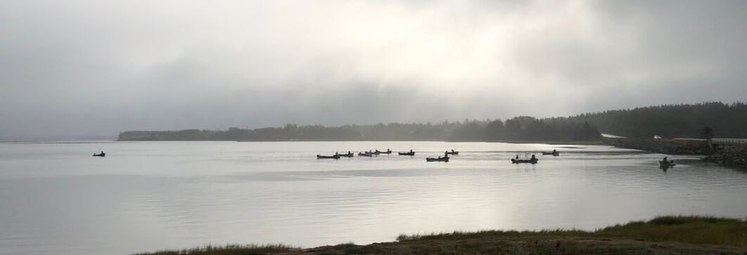
Fishermen out first thing in the morning
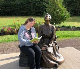 L.M. Montgomery statue
Thursday, September 26th: The Green Gables Coastal Drive took us north and then west, seeing more gorgeous red sand beaches and various bays and coves. We were also confused by a number of areas where we could see floating grids that we didn't understand; later research discovered these to be oyster cultivation sites. As the drive's name implies, this is also the area of PEI where Lucy Maud Montgomery lived while writing Anne of Green Gables, and where it is set. Neither of us had read the book, but it seemed interesting, so we stopped at the homestead where Montgomery lived and worked as an assistant postmaster. It now has a bookstore, and Sara grabbed a copy of the book to read. We also stopped at a nearby park where a statue of the author was recently installed, and then at the Green Gables heritage place, which featured an unexpectedly modern and unabashedly touristy facility. We wandered into the Haunted Woods nearby, but a resurgence of mosquitos and a nearby golf course turned us back. This was also the site of my closest encounter with wildlife on the trip, as two chipmunks tore down the trail towards us. The first one ran around me; the second one took a shortcut, using my shoe as a springboard to run up my leg and then vault off my calf in hot pursuit. The sound I emitted in surprise cannot, by any interpretation, be considered manly. Unfortunately, this was not caught on tape by any of the nearby tourists, all of which were now either confused, scared or joining Sara and I in laughter.
 Unique display at the Potato Museum
We headed to the west side of the island, aiming for the Canadian Potato Museum in O'Leary. Apparently potatoes are a things we want to learn more about! Unfortunately, we learned that their kitchen was closed for the season, so we searched for a restaurant in Google Maps on the way there. It turned out to be inside a multi-use facility (arena, pool, bowling, etc.) in Summerside. It wasn't described as such by Google Maps, leading to some confusion as we arrived, but the food was good. The potato museum was, in my opinion, a little better than the one in New Brunswick, but the lack of french fries at the end was a definite downside. After that we headed towards the bridge off the island, with one last stop on PEI first. We'd seen a number of ads for COWS ice cream, which is apparently one of the best ice creams in the world, but we'd missed our other chances to visit one of their shops: they are only on one of the ferry boats (not the one we were on), we were about 30 minutes too late for the Charlottetown location once we checked into our hotel the day before, and the one on the north side of the island had closed for the season. That left the location near the Confederation Bridge as our last chance, and it closed at 6 pm. We pulled into the parking lot at 5:54 pm, walking in to find an employee just starting to take down their flavour signs for the day, but the manager insisted that of course we weren't too late to grab ice cream! I took a double scoop of Peach Melba, while Sara went with PEI Apple Crisp and Sea Salted Toffee. I'm not sure if it's the best in the world, but we were both very pleased with them!
|
The Confederation Bridge was very impressive. It takes about 10 minutes to drive it, which feels ridiculously long. It's apparently the longest bridge over ice-covered water in the world, although it's nowhere near the longest overall bridge. Unfortunately, the high concrete sides also interfere with the view. After crossing, we swung north and west into Moncton, getting to our hotel as it got dark. We had seen a sign for St-Hubert shortly before exiting the highway, and backtracked for dinner there. Neither of us had had it before, and for some reason (maybe the mascot?) had thought it was fried chicken, not rotisserie. Once we adjusted our expectations, we found it to be quite tasty.
|
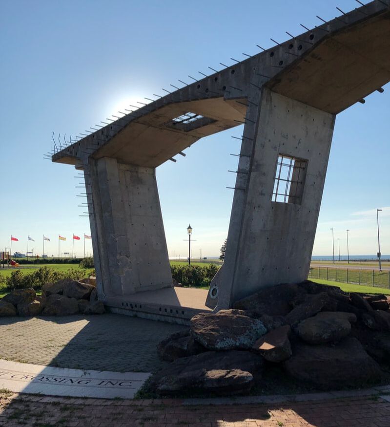
Confederation Bridge Monument
|
Friday, September 27th: This day was built around the tides. St John, New Brunswick, is where the St John River flows into the Bay of Fundy, which has the highest tides in the world. As a result of this, by the time you get to high tide, the river actually flows backwards, with water from the Bay going upriver. "Nature's tug-of-war," as one sign puts it, happens at the Reversing Rapids (formerly and more inaccurately called the Reversing Falls) inside St John. We got there about 10:30 am, with high tide still (I thought) about an hour away, and were able to see from the lookout area how different parts of the rapids shifted as the water flow from the Bay increased. By the time 11:15 rolled around, everything was flowing upstream nicely, and I discovered that I'd misread the tide charts, as high tide in St John actually happened earlier than at the Hopewell Rocks a couple hours drive to the east - our next planned destination. By this time, though, we'd read more on the rapids, and discovered that the flow actually reversed at what is called "slack tide", about 2.5 hours after high tide. We decided to stick around, having a brief (mis)adventure as we tried to take a shortcut to a nearby mall for lunch and blundered into marshy terrain. We made it back in time for slack tide, though, and were amazed at the difference from a couple hours earlier, with the previous white water now mostly calm, and the currents still observable but not fast-moving at all. We chatted with the only other people at the lookout, a couple from Alabama who were visiting off a cruise ship, and they said that they really enjoyed it as a vacation method - visiting a different city every day, and sleeping in the same bed every night. This was basically the opposite of how Sara and I travelled - we were moving around each day, and sleeping in a different place every night - leading Sara to dub our trip the anti-cruise. :-)

High Tide in St John
|

Marshy Adventure
|

Slack Tide in St John
|
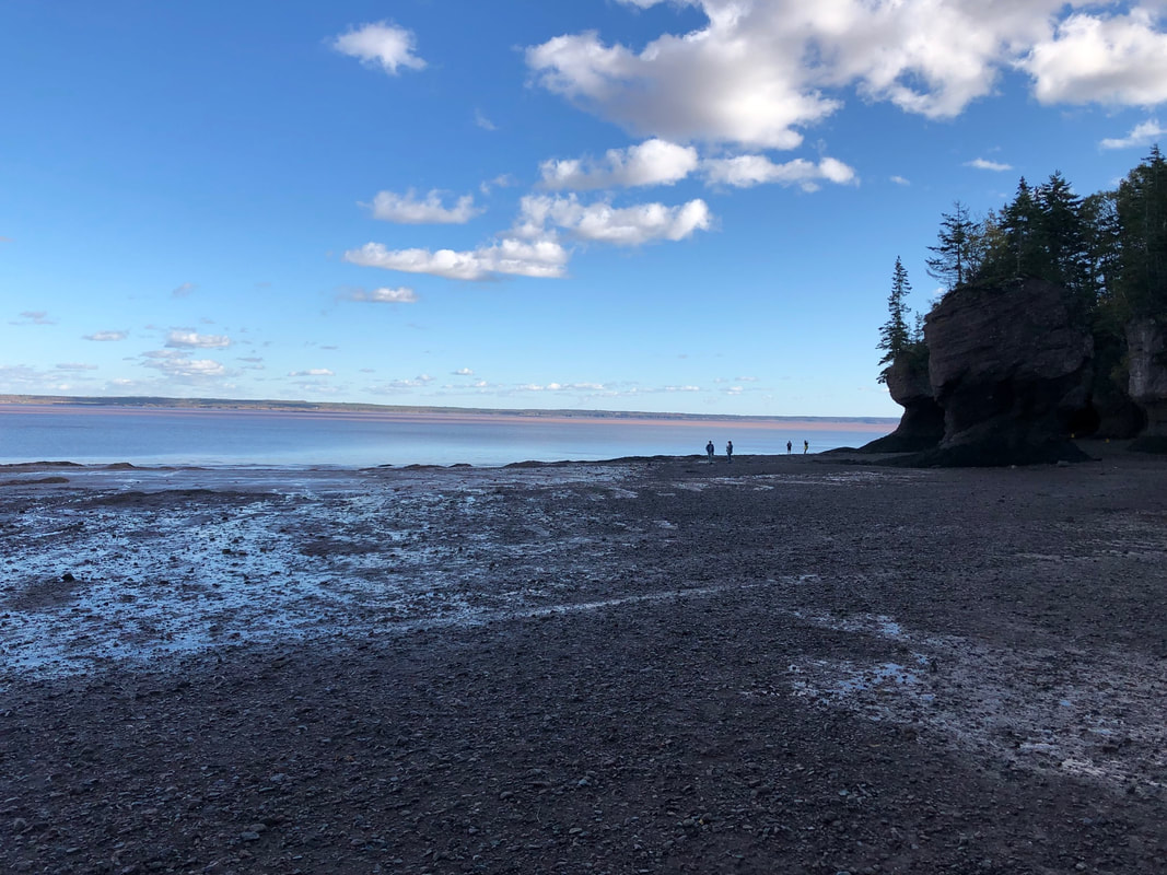
Over the course of the next half hour, we watched the currents heading upstream lose ground against the downstream flow, until by 1:45 the whole surface of the river was flowing downstream. We then headed out for the Hopewell Rocks. This is a set of stone formations in the eastern part of the Bay of Fundy. At high tide, their bases are covered by water; by low tide, the water has receded, and they stand alone. Low tide was still a couple hours away when we arrived, but at this time of year, they close the park at 5 pm, so we only had about an hour to get down to the rocks and do our sightseeing. It was definitely worth it, though, mostly because of the size of the rocks and the beautiful colours in the area.
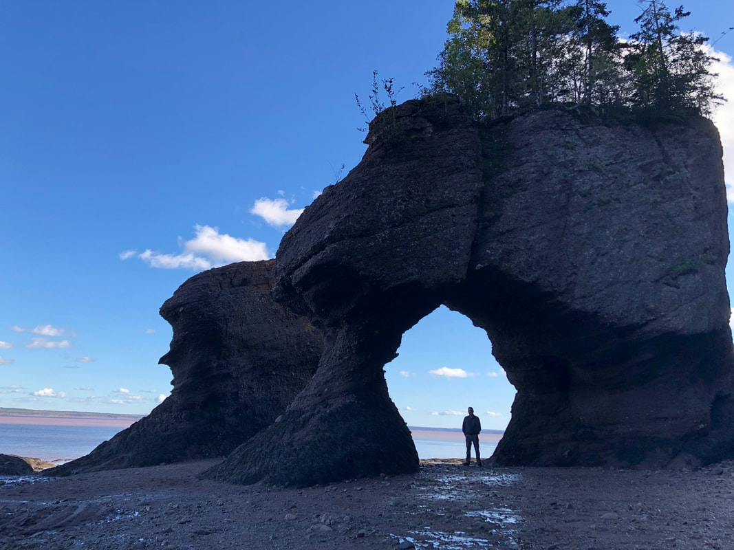
Duncan @ Hopewell Rocks
|
Note the people beside the rocks for scale

The beautiful colours of Hopewell Rocks
|
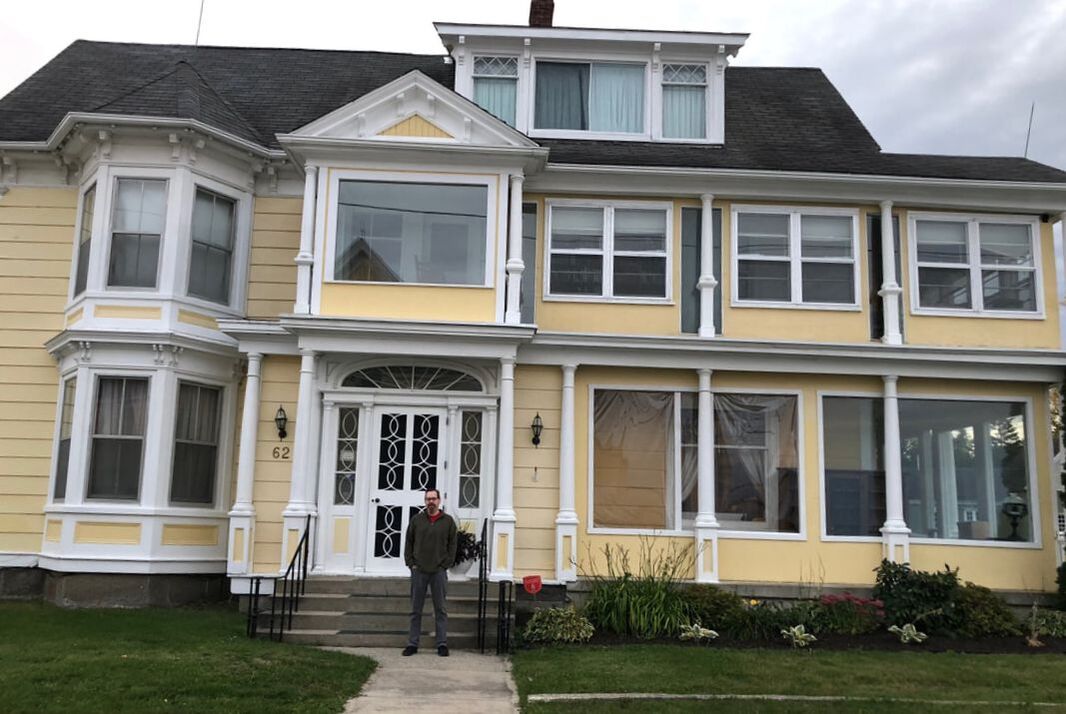
Leaving Hopewell, we drove north, making a couple more hours' progress before getting to an overnight stop in Miramichi at another converted mansion, where once again we picked up keys at the door as the innkeeper had gone home for the night. Our room was named the "Governor's Lady", and came complete with the most authentic key of our trip and a copy of the book the room was named after.
The Governor's Mansion
|
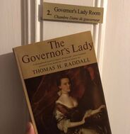
The Governor's Lady
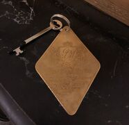
Key to our Room
|
Saturday, September 28th: We decided to plan for an overnight stop at Québec, hoping to arrive in late afternoon and have a chance to look around. We headed north from Miramichi, cutting across the Acadian Peninsula, driving along the coast of Chaleur Bay, and then cutting across the Gaspé Peninsula to the St Lawrence River. The weather in the morning was great, and even after the clouds rolled in, this was the only major section of the drive that could rival the Cape Breton Highlands for beauty. The trees were in full autumn garb, and hill after hill presented us with vibrant reds, oranges, yellows, and greens. The portion across the Gaspé followed the Matapedia Valley and the river of the same name, and was especially gorgeous. We were lucky that the day's heavy rain didn't settle in until we had turned west and headed into less scenic areas along the St Lawrence. Google again helped us find a good restaurant for lunch, and we split sweet and savoury crepes at Le Crêpe Chignon in Rimouski. We actually split driving duties in the afternoon, and I took my longest stint behind the wheel for the trip (about 90 minutes) to drive us the last of the way into Québec.
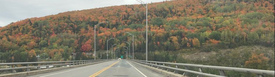
The fall colours throughout the New Brunswick & Quebec hills were incredible
We stayed at Le Monastère des Augustines, a converted monastery in Old Québec that offered a variety of wellness programs as well as a selection of rooms in either authentic or contemporary styles. We went contemporary, mostly for the private bathroom. We spent a bit of time looking through their museum, which gave us some information about what life in the monastery would have been like in centuries past, and admiring the amazing way they integrated modern building elements with the historic structure. We then headed out to see Old Québec, looking at the Notre-Dame de Québec basilica and the outside of the Château Frontenac, but honestly just walking down random streets and seeing the old buildings was wonderful. We got out to the top of the city walls, seeing cruise ships, cargo ships, and Canadian Coast Guard vessels below us, and followed the Governor's Promenade along the outside of the Citadel. Unfortunately it got dark while we were on there, so we cut the tour of the Plains of Abraham short and headed back to the hotel, with a stop along the way for poutine.
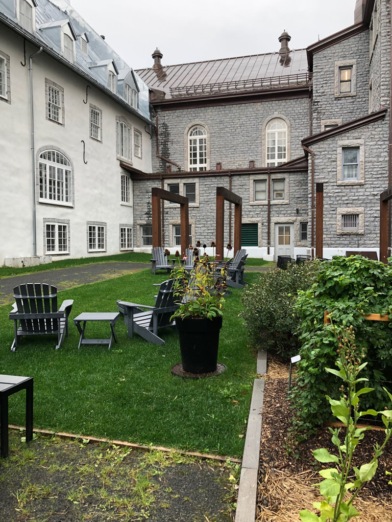
Courtyard of the monastery
|
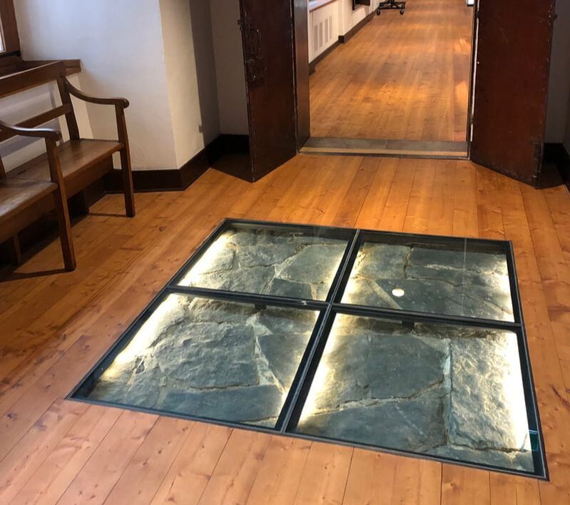
Historic flooring peeking through
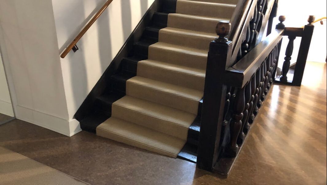
Historic staircase, complete with tilt
|
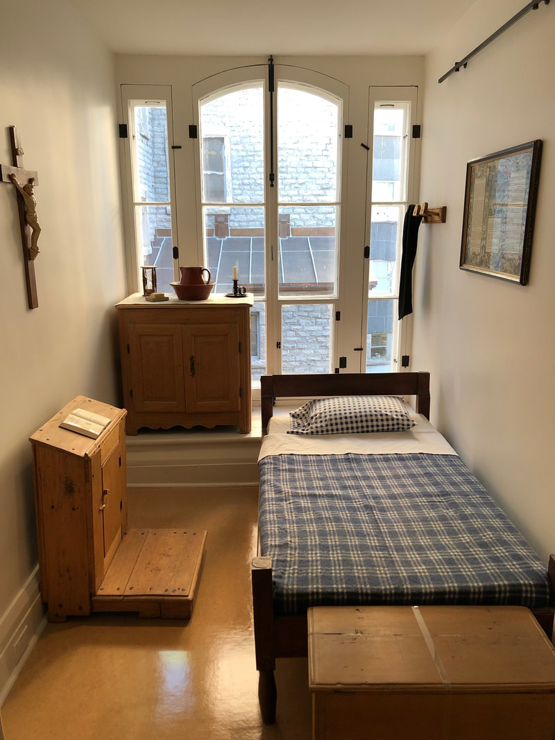
Authentic room in the monastery
|
 Cora's breakfast
Sunday, September 29th: Our last day away from home. We took a fairly leisurely morning and grabbed breakfast at a Cora before hitting the road. We took Route 138 out, preferring a more scenic drive. Once the 138 crossed inland of Route 40 past Trois-Rivières, we switched to the larger highway, stopping in Montreal for lunch at Baton Rouge - another place that we like, and have not too far from us in Toronto, but can't get to easily without a car. After that, it was straight highway driving, with the biggest problem being Toronto traffic. We finally made it back to our place about 8:30 pm, threw laundry in for the next day, and started settling back into our normal lives.
The trip was a lot of fun. We saw a bunch of great landscapes, and both of us came away from it with a much better understanding of the scale of Canada, and of the Maritime provinces. I feel like the only part of the trip that really could have been extended was the Cape Breton Highlands. That's an area that I could easily spend a couple days hiking in - as long as I remember to bring something to keep the mosquitos away! We are planning to go to Supernova again next year, so that might happen, but we are also both interested in getting out to Newfoundland, which is a very long ferry ride away from Nova Scotia, so next year might be just Newfoundland and Supernova. Finally, we both enjoyed our visit last year to the Oaklawn Farm Zoo, about 1.5 hours northwest of Halifax, but just couldn't work it into the schedule this year, as it wasn't near anything else we really wanted. We will have to wait and see what 2020 will bring!
© COPYRIGHT 2024. ALL RIGHTS RESERVED.